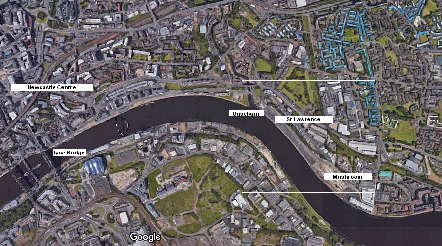
Map 1 (above) shows the position of the St Lawrence and Mushroom areas of Newcastle in relation to the current centre of the city.
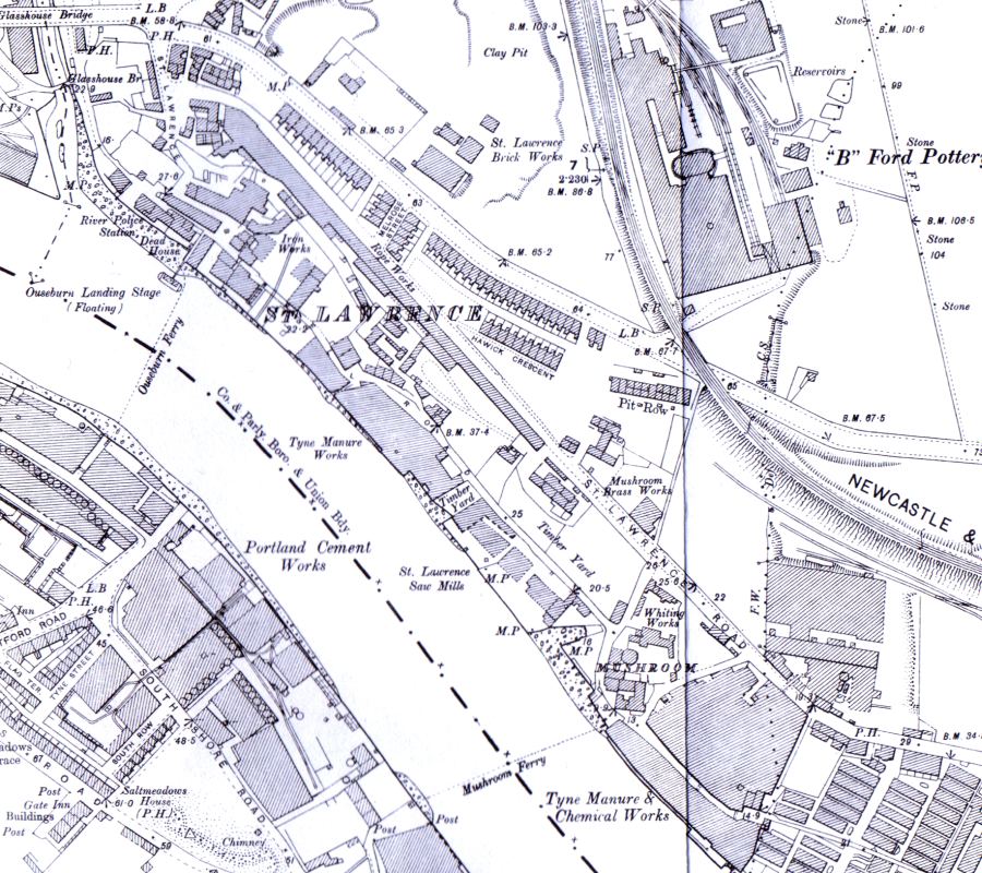
Map 2 shows the St Lawrence and Mushroom areas as depicted by an Ordnance Survey dated 1898. Note that on this stretch of river there are no shipyards shown.
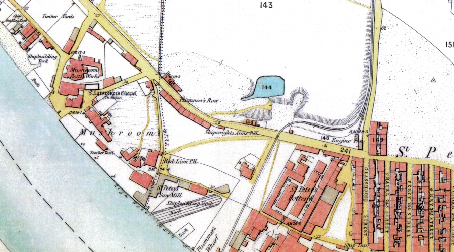
Map 3 is also from the 1898 survey and is centred on the Mushroom area of the town and could be overlayed on Map 4 which is from the 1859 survey.
Map 4 shows the position of three shipyards, two small ones at top left and a larger one at bottom centre.
Although Anderson, Johnson & Littlejohn didn't commence building ships until 1891 it can only be assumed that they were based at one of these three yards.
All yards had disappeared by the 1898 survey which is only 4 years after the yard was put up for sale.
The description of the yard assets, including a 150ft Slipway with launching cradle, two slipways and various large items of machinery would suggest that the larger site may be where they were based (but see later).
As there is no record of another shipbuilding enterprise taking over the yard it must have been built over by the Tyne Manure & Chemical Works and the St Lawrence Foreign Cattle Sanatorium (partly off the bottom of the map).
Although the 1898 map shows St Lawrence to the north and Mushroom to the south the St Lawrence Foreign Cattle Sanitorium is south of the Mushroom and the whole area is bounded by the river on one side and St Lawrence Road on the other, suggesting that the naming of the area is fluid.
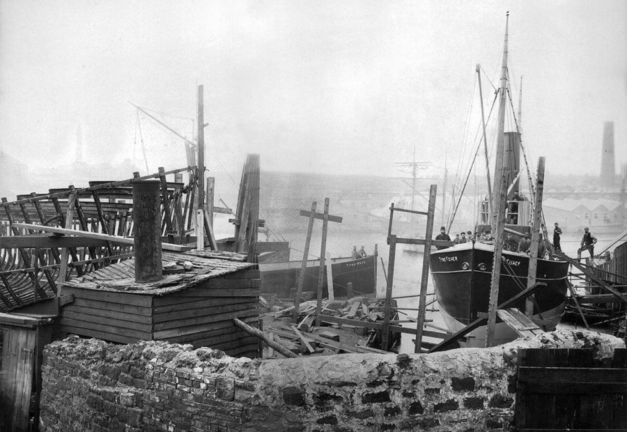
Above photo is copyright of John Anderson
The above photo is one of only two known photos of the Anderson Laverick yard, both of which were kindly submitted by John Anderson.
If the wall in the foreground is the boundary of the yard then the yard must have been quite narrow.
A nearly complete TYNE FISHER is shown hauled out of the river on a cradle, suggesting this is a patent slip rather than a building berth with launch ways.
There is a quay to the left of the cradle and to the extreme left are iron frames on a building berth prior to plating being attached.
On the extreme right of the photo and across on the Gateshead side of the river can be seen some low buildings, running at right angles to the river edge, behind them some larger buildings and further behind them a prominent chimney.
On the extreme left of the photo and again in the background on the Gateshead side of the river is another slimmer chimney.
Map 4 (an extract from Map 3) shows two possible chimneys and lines of sight back to one of the yards closer to Newcastle.
Is this then the site of the Anderson Laverick yard?
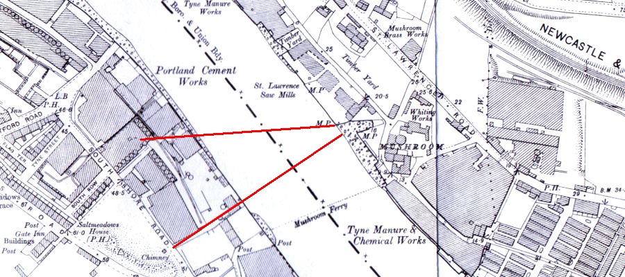
Above - Map 4: Mushroom in 1898 with lines of sight to "chimneys". Map is copyright of The Ordnance Survey
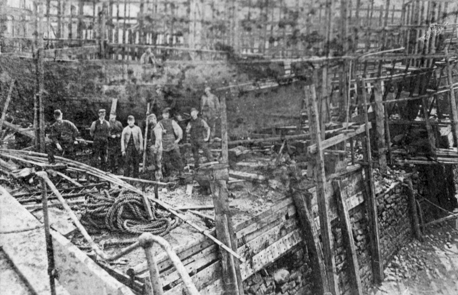
Above photo is copyright of John Anderson
In the above photo the yard is viewed from the river at low tide.
The quay wall is visible as is the stoney "beach" of the river edge.
There is a group of men posing in front of what appears to be one or more unfinished hulls above the level of the quay wall.
Presumably these hulls would be closer to the river at high tide to enable them to be launched easily.
At the left of the group of men and slightly separated from the rest is a figure that could well be Douglas Murray Anderson.
At the bottom of the photo, next to the bent handrail, there appears to be an indentation in the quay wall.
Could this be the edge of the patent slipway and the photo be taken from the deck of a boat on the slipway (conjecture).
|